欢迎登陆低空经济无人科技网!
 September 4 -6, 2026
主办单位:Shandong Provincial People's Government
举办场馆:Qingdao International Convention and Exhibition Center
举办地址:Qingdao International Convention and Exhibition Center
展会面积:60000+ ㎡
展商数量:1000+家
观众数量:80000人次+人
Time: September 4 -6, 2026 Location: Qingdao International Convention and Exhibition Center (Hongdao Pavilion)
General situation of exhibition
2026 China International Consumer Electronics Expo and Qingdao International Low-altitude Economy and UAV System Industry Exhibition, hosted by Shandong Provincial People's Government, Qingdao Municipal People's Government, China Chamber of Commerce for Import and Export of Electromechanical Products, China Institute of Electronics, and Beijing Zhongsheng International Exhibition Co., Ltd., is a rare national-level professional exhibition with double exhibitions and cross-border integration of consumer electronics and low-altitude economy unmanned systems, based in Qingdao, radiating the whole country and linking the whole world, and building a core platform for industrial collaboration and business cooperation.

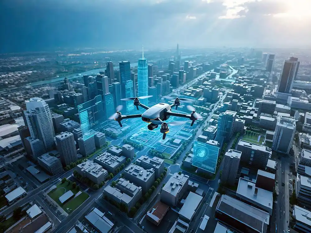
As a national strategic emerging industry, low-altitude economy and UAV industry are the concentrated expression of new quality productivity, and are also the inherent requirements for building a modern industrial system and promoting high-quality development. Low-altitude economy was written into the government work report, which clearly put forward the goal of promoting low-altitude economy to form trillion-level market regulations by 2030. Developing low-altitude economy and unmanned aerial vehicles is an important measure to create a new engine of economic growth and an inevitable requirement for building a modern industrial system and promoting the high-quality development of low-altitude economic aircraft. Focusing on enhancing industrial technological innovation capability and enhancing the competitiveness of industrial chain supply chain. The 2026 Qingdao National Low-altitude Economy and UAV System Industry Exhibition will be held in Qingdao International Convention and Exhibition Center (Hongdao Pavilion) from September 4 to 6. This high-level and large-scale comprehensive professional activity, which integrates academic exchange, business cooperation and simulation experience, plays an important bridge role in promoting UAV scientific and technological innovation, strengthening international exchanges and cooperation, and promoting the healthy development of aerospace, unmanned driving and UAV system industries. .
In order to strengthen the international exchange of industries, the organizing committee issued invitations to the world in six languages: Chinese, English, Russian, Korean, French, German and accurately connected with global partners. Relevant scientific research units, manufacturers, sellers and operators at home and abroad are invited to actively sign up. Warmly welcome the leaders of industry units to visit and guide, discuss and exchange, and share the grand event.
I. Organizational structure
Organizer:
Shandong Provincial People's Government
Organizer:
Qingdao Municipal People's Government
China electromechanical import and export chamber of commerce
China Institute of Electronics
Beijing zhongsheng international exhibition co., ltd
Executive organizer:
Beijing zhongsheng international exhibition co., ltd
Media full name report:
Low-altitude economic unmanned technology network
II. Time/Place
Time: September 4 -6, 2026
Venue: Qingdao International Convention and Exhibition Center (Hongdao Pavilion)
III. the highlights of the exhibition
Gather the world's top low-altitude economy, unmanned aerial vehicles and consumer electronics enterprises, focus on displaying cutting-edge scientific and technological products and technologies, integrate domestic and foreign resources, and create a benchmark exhibition of "full-chain display+scene landing+policy empowerment+transaction docking". Combining the advantages of urban scenes, create an all-round exhibition of "low-altitude cultural tourism+maritime inspection+emergency rescue+urban logistics" to gather domestic and foreign resources of production, learning, research, use and capital, and build technology research and development+achievement transformation.
Ⅳ, exchange activities
Industry exchange: gather leaders, discuss trends and lead the future of the industry.
Economic and trade negotiations: promote the accurate docking of domestic and foreign enterprises and expand cooperation opportunities.
Technical exchange: focus on cutting-edge technologies, accelerate the transformation of achievements, and promote industrial upgrading.
Roadshow: Show innovative achievements, help start-ups grow and tap market potential.
Popular science research: spreading scientific and technological knowledge, enlightening innovative thinking and cultivating future talents.
V. Introduction of the Exhibition Hall
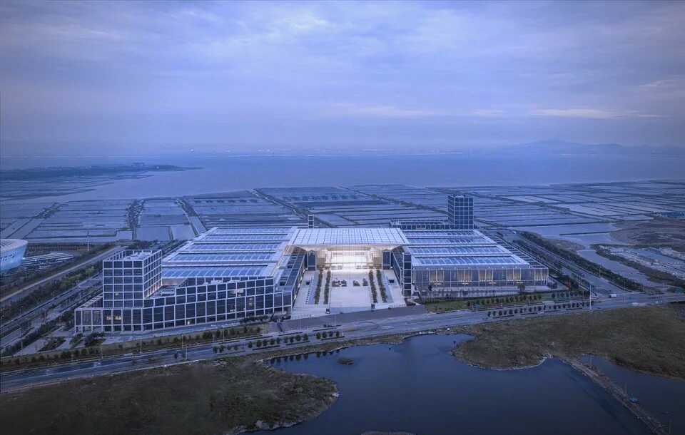
Qingdao International Convention and Exhibition Center (Hongdao Pavilion) was designed by GMP, a famous German design company, according to the comprehensive experience of the fifth conference. The indoor building area is 150,000 square meters, with 14 exhibition halls. Among them, there are four street-style disordered single-story exhibition halls, the East Hall series style is the first floor, the simple walking station has columns, and the exhibition hall on the second floor is column-free space, which can meet a variety of international exhibitions. In order to meet the needs of the conference, the double-deck exhibition hall has an immersive design, with independent logistics inflow channels, and service stations, catering areas, business areas and leisure areas on both sides of the exhibition hall, with an outdoor exhibition area of 200,000 square meters.
Qingdao International Convention and Exhibition Center (Hongdao Pavilion) is located in the core area of Qingdao High-tech Zone.
Convenient transportation. Take Metro Line 8, you can reach all districts in Qingdao within 45 minutes, Qingdao Jiaodong International Airport (newly-built 4F class) with 5 stops in 21 minutes, Hongdao High-speed Railway Hub Station with 2 stops in 4 minutes, Qingdao North high-speed railway station with 4 stops in 19 minutes, and Laiwu High-speed Railway takes only 3 hours to Beijing and 4 hours to Shanghai. It is 33 kilometers away from Qingdao Port, and the expressway takes 1 hour to reach the surrounding areas and cities such as Yanhe and Weihai. Qinglan Expressway, Qingyin Passenger Speed, Shenhai Expressway, Bay Bridge and a number of national highways are directly connected to the exhibition center, and the freight logistics is unimpeded 24 hours a day.
VI. Scope of participation
1) Low-altitude economic industries
Navigation (helicopter), unmanned aerial vehicle, eVTOL aircraft, aviation materials, airborne equipment, etc. Agriculture, forestry, animal husbandry and fishery, low-altitude logistics, emergency rescue, medical rescue, aerial inspection, private flight, aerial photography, air sports, flight training, entertainment and sightseeing (low-altitude tourism), meteorological monitoring and safety, aviation maintenance, aviation paint, airport facilities construction, etc.
2) UAV and its application
Fixed-wing UAVs, multi-rotor UAVs, vertical take-off and landing UAVs, unmanned helicopters, unmanned airships, unmanned paragliders, unmanned submersibles, etc., and aerial photography of agriculture, forestry and plant protection, electric line inspection, petrochemical disaster prevention and mitigation, forest fire prevention, film and television aerial remote sensing mapping, police investigation, disaster investigation, environmental protection, atmospheric research, geological exploration, meteorological observation, logistics and transportation, highway inspection, postal express delivery, maritime monitoring and other fields;
3) Task load class
Image equipment video equipment infrared detection laser ranging panoramic camera multifunctional optical stabilization platform TV camera infrared scanner low-light-level TV camera framing camera aerial video recorder aperture radar photoelectric pod sensor electronic countermeasure task load tilt photography, etc.
4) Navigation and control avionics
Navigation and positioning equipment GPS GNSS inertial navigation gyro integrated navigation magnetometer automatic control system autopilot flight control computer flight control software and hardware simulation system speed measuring device control simulation virtual visual system steering gear servo mechanism;
5) Communication and data link technology
Wireless link satellite digital data link transmitting ground control station equipment vehicle receiver transmitter communication system airborne equipment transponder, etc.
6) Energy and power
Electronic fuel control of power engine motor battery propeller gearbox, etc.
7) Materials for overall design of pneumatic structure
Micro UAV unmanned submersible unmanned ship unmanned vehicle unmanned aerial vehicle unmanned power parachute unmanned boat unmanned aerial vehicle composite coated landing gear radome, etc.
8) emission recovery class
Launcher launcher recovery umbrella blocking net recovery system landing gear automatic take-off and landing system brake system shock absorber, etc.
9) Model airplane
Aviation model, remote control equipment, model engine, motor, model battery, fuel and driving energy, model manufacturing equipment and tools, various materials for manufacturing models, paints, flight simulators, model books and periodicals, etc.;
10) Anti-UAV class
Anti-unmanned machine guns, photoelectric detection, scanning radar, signal detection, hand-held jamming equipment, navigation deception protection station, intelligent net capture system, early warning management system, etc.
11) unmanned technology
Unmanned aerial vehicle (UAV), unmanned ground vehicle (UGV), unmanned surface boat (USV), unmanned submersible vehicle (AUV), unmanned robot, humanoid robot, service robot, industrial robot, etc.
12) Satellite/radar category
Satellite applications: communication satellites, navigation satellites, earth observation satellites, radar remote sensing satellites, meteorological satellites, environmental exploration satellites, scientific and technological experimental satellites, satellite platforms and satellites, commercial satellites, ground equipment and terminals, data and application services, and communication satellites equipped with transponders and antennas.
Radar applications: early warning radar, fire control radar, guidance radar, airborne radar, shipborne radar, anti-stealth radar, meteorological radar, traffic management radar, low-altitude security radar, bird detection radar, millimeter wave radar.
VII.charging standards
(1) Standard booth: 11,800 yuan /9㎡, double-sided opening 12,800 yuan.
(2) bare land: 1180 yuan/m 2; (from 36 square meters).
Remarks: (The standard booth size is 3x3 = 9m2, including two or three exhibition boards, negotiation tables and chairs, two spotlights, 220V/5A power socket, carpet and company name fascia. Bare land: Without any facilities, the exhibitor can entrust the organizer to designate a builder for docking design, and the construction cost of production and construction shall be borne by himself).
(3) Please contact the Organizing Committee for conference report, technical exchange, publication promotion, advertising sponsorship, on-site activity sponsorship and other publicity forms.
VIII. Participation Process and Services
(1) The booth shall be conducted according to the principle of "first registration, first payment and first arrangement".
(2) Fill in the application form for participation, sign and seal it, and then scan it and send it to the organizing committee's WeChat.
(3) The exhibitors shall remit the money to the account designated by the Organizing Committee within 2 days from the date of registration.
(4) If the exhibitor fails to pay the money within the specified time, the organizer has the right to transfer the booth or cancel the participation qualification.
(5) For exhibitors who meet the registration requirements, the Organizing Committee will provide exhibitors' manuals, admission confirmation and other relevant documents.
IX. Exhibition consultation:
Qingdao low-altitude economic exhibition organizing Committee Chu
Contact: Manager Xie
Tel: 13671039528
WeChat official account: uasexpochina
Email: 2378753147@qq.com.
Website: www.uasexpo.cn
1) Low-altitude economic industries
Navigation (helicopter), unmanned aerial vehicle, eVTOL aircraft, aviation materials, airborne equipment, etc. Agriculture, forestry, animal husbandry and fishery, low-altitude logistics, emergency rescue, medical rescue, aerial inspection, private flight, aerial photography, air sports, flight training, entertainment and sightseeing (low-altitude tourism), meteorological monitoring and safety, aviation maintenance, aviation paint, airport facilities construction, etc.
2) UAV and its application
Fixed-wing UAVs, multi-rotor UAVs, vertical take-off and landing UAVs, unmanned helicopters, unmanned airships, unmanned paragliders, unmanned submersibles, etc., and aerial photography of agriculture, forestry and plant protection, electric line inspection, petrochemical disaster prevention and mitigation, forest fire prevention, film and television aerial remote sensing mapping, police investigation, disaster investigation, environmental protection, atmospheric research, geological exploration, meteorological observation, logistics and transportation, highway inspection, postal express delivery, maritime monitoring and other fields;
3) Task load class
Image equipment video equipment infrared detection laser ranging panoramic camera multifunctional optical stabilization platform TV camera infrared scanner low-light-level TV camera framing camera aerial video recorder aperture radar photoelectric pod sensor electronic countermeasure task load tilt photography, etc.
4) Navigation and control avionics
Navigation and positioning equipment GPS GNSS inertial navigation gyro integrated navigation magnetometer automatic control system autopilot flight control computer flight control software and hardware simulation system speed measuring device control simulation virtual visual system steering gear servo mechanism;
5) Communication and data link technology
Wireless link satellite digital data link transmitting ground control station equipment vehicle receiver transmitter communication system airborne equipment transponder, etc.
6) Energy and power
Electronic fuel control of power engine motor battery propeller gearbox, etc.
7) Materials for overall design of pneumatic structure
Micro UAV unmanned submersible unmanned ship unmanned vehicle unmanned aerial vehicle unmanned power parachute unmanned boat unmanned aerial vehicle composite coated landing gear radome, etc.
8) emission recovery class
Launcher launcher recovery umbrella blocking net recovery system landing gear automatic take-off and landing system brake system shock absorber, etc.
9) Model airplane
Aviation model, remote control equipment, model engine, motor, model battery, fuel and driving energy, model manufacturing equipment and tools, various materials for manufacturing models, paints, flight simulators, model books and periodicals, etc.;
10) Anti-UAV class
Anti-unmanned machine guns, photoelectric detection, scanning radar, signal detection, hand-held jamming equipment, navigation deception protection station, intelligent net capture system, early warning management system, etc.
11) unmanned technology
Unmanned aerial vehicle (UAV), unmanned ground vehicle (UGV), unmanned surface boat (USV), unmanned submersible vehicle (AUV), unmanned robot, humanoid robot, service robot, industrial robot, etc.
12) Satellite/radar category
Satellite applications: communication satellites, navigation satellites, earth observation satellites, radar remote sensing satellites, meteorological satellites, environmental exploration satellites, scientific and technological experimental satellites, satellite platforms and satellites, commercial satellites, ground equipment and terminals, data and application services, and communication satellites equipped with transponders and antennas.
Radar applications: early warning radar, fire control radar, guidance radar, airborne radar, shipborne radar, anti-stealth radar, meteorological radar, traffic management radar, low-altitude security radar, bird detection radar, millimeter wave radar.

专属微信
联系电话:xie13671039528
工作时间:周一至周五 09:00-18:00


 微信扫一扫
微信扫一扫
 发布信息
发布信息